Beinecke Library’s Vinland Map determined to be a fake
—By Mike Cummings
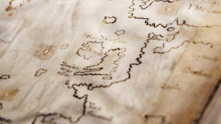
The Vinland Map, once hailed as the earliest depiction of the New World, is awash in 20th-century ink. A team of conservators and conservation scientists at Yale has found compelling new evidence for this conclusion through the most thorough analysis yet performed on the infamous parchment map.
Acquired by Yale in the mid-1960s, the purported 15th-century map depicts a pre-Columbian “Vinlanda Insula,” a section of North America’s coastline southwest of Greenland. While earlier studies had detected evidence of modern inks at various points on the map, the new Yale analysis examined the entire document’s elemental composition using state-of-the-art tools and techniques that were previously unavailable.
The analysis revealed that a titanium compound used in inks first produced in the 1920s pervades the map’s lines and text.
“The Vinland Map is a fake,” said Raymond Clemens, curator of early books and manuscripts at Yale’s Beinecke Rare Book & Manuscript Library, which houses the map. “There is no reasonable doubt here. This new analysis should put the matter to rest.”
The new study also uncovered evidence that the map deception was intentional. A Latin inscription on its back, possibly a bookbinder’s note guiding the assembly of the Speculum Historiale — an authentic medieval volume and the likely source of the map’s calfskin parchment — is overwritten with modern ink to appear like instructions for binding the map within the genuine 15th-century manuscript. Read the full article on YaleNews.


