Extraordinary collection of early maps on display at the Beinecke Library
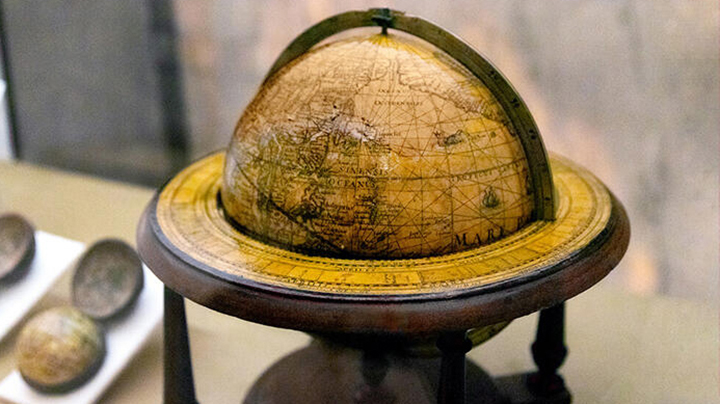
The World in Maps, 1400–1600, a new exhibition at the Beinecke Rare Book & Manuscript Library, presents a selection of the most impressive and historically important maps in the library’s collection from the late Medieval and Early Modern periods
Yale University Library houses one of the most significant map collections in North America, including the continent’s largest single assemblage of portolans. Portolans, from the Italian meaning “related to ports or harbors,” are colorful, hand-drawn maps that early seafarers relied on for navigation. They are characterized by their “rhumbline” networks (series of web-like grid lines) radiating out from a “compass rose,” which marks the cardinal directions.
The exhibit—organized by Ray Clemens, curator of early books and manuscripts, with Kriste Herdman, a PhD candidate in the medieval studies program—focuses primarily on European maps, but there are also Middle Eastern and Asian world maps that reveal common elements and and highlight differences. Also on display are some map forgeries, with explanations of how scientific and historic analyses determined that they were fakes.
World in Maps, 1400–1600 is on display at Beinecke Library until January 8, 2023. Read more about the exhibition at YaleNews.
Photo by Allie Barton